Wildfire Preparedness for South Georgia Homeowners
Key Takeaways
- South Georgia’s primary fire season runs February through May, with a secondary risk window in late summer if drought persists.
- Fires here move fast and low through dry ground cover — mowed grass, cleared pine straw, and trimmed lower pine branches within 30 feet of structures matter most.
- No permit is needed to burn hand-piled leaves and limbs (since 2021) — but keep fires 25 ft from woods, 50 ft from structures, and attended; agricultural and land-clearing burns still need a GFC permit (call 1-800-GA-TREES).
- A Fire Weather Watch means dangerous fire weather is possible in the next 12–72 hours; a Red Flag Warning means critical conditions are here or imminent — a hard stop on all outdoor burning, even with a permit.
- Fire Watcher (fire.riktom.com) maps NASA FIRMS satellite fire detections hourly, plus active red flag warnings, for South Georgia and North Florida.
- If a fire is approaching, call 911, leave early rather than waiting for an official order, close windows and doors, and shut off propane at the tank.
South Georgia doesn't look like wildfire country to most people. There are no mountains, no chaparral, no dramatic canyon geography. But the region's combination of flat terrain, longleaf and slash pine forests, wiregrass understory, and periodic drought makes it one of the most fire-prone landscapes in the eastern United States — and spring fire season regularly catches homeowners and rural residents off guard.
This guide covers when fire risk peaks in South Georgia, what you can do to protect your property, and — critically — how to stay informed when a fire starts somewhere in your county.
When Is Fire Season in South Georgia?
Unlike the western United States, where fire season peaks in late summer and fall, South Georgia's primary fire season runs from February through May. This counterintuitive timing is driven by several factors:
- Dormant vegetation. Grasses and understory plants are dry and dead from winter before spring green-up begins, creating an ideal fuel bed.
- Low humidity. Winter and early spring bring the lowest relative humidity of the year to the region.
- Wind. Cold fronts moving through in late winter and spring bring gusty, dry winds that accelerate fire spread dramatically.
- Prescribed burns. Land managers intentionally burn hundreds of thousands of acres across South Georgia each spring to maintain longleaf pine ecosystems and reduce fuel loads. Most smoke you see in February–April is intentional — but escaped prescribed burns do happen. (Our landowner’s guide to controlled burning covers how these burns are done right.)
A secondary fire risk period occurs in late summer (August–September) if drought conditions persist, as they did across much of Lowndes and surrounding counties in 2025 and again in spring 2026.
The rest of the year carries lower but not zero risk. Summer’s near-daily thunderstorms keep fuels moist, but lightning from those storms is a leading natural ignition source. Fall dry spells can elevate fire danger again in drought years, and even winter can see brief spikes during dry, windy post-frontal conditions.
Understanding Fire-Weather Warnings
The National Weather Service issues two products specifically for fire weather, and the difference between them matters.
A Fire Weather Watch means conditions favorable for dangerous fire weather are possible in the next 12 to 72 hours. It’s the heads-up — comparable to a watch for severe storms. When a Fire Weather Watch is issued for your county, postpone any planned burning and pay attention to the forecast.
A Red Flag Warning is the more serious product: critical fire weather conditions are either occurring now or will occur shortly. It’s issued when a specific combination is met or expected — low relative humidity (typically below 25–30%), sustained winds or frequent gusts (often 15+ mph), warm temperatures, and dry fuels. When a Red Flag Warning is in effect for your county:
- Any spark — a vehicle pulling off into dry grass, a downed power line, a tossed cigarette, an escaped debris burn — can start a fire that spreads rapidly and becomes difficult to control.
- Outdoor burning is prohibited or strongly discouraged by the Georgia Forestry Commission. Do not burn anything outdoors, even with a valid permit.
- Existing fires already burning may make rapid, erratic runs.
The same logic applies across every NWS product, and it’s worth internalizing: a Watch means conditions are favorable for the hazard — be prepared and stay informed. A Warning means the hazard is occurring or imminent — take action now.
What Drives Fire Danger
Behind every fire warning is a set of measurable conditions. The four that matter most in South Georgia:
Relative humidity. Dry air pulls moisture out of vegetation, making it more flammable. When daytime humidity drops below about 30%, fine fuels — grass, pine straw, leaf litter — become highly receptive to ignition. South Georgia’s lowest humidity days typically come in spring behind cold fronts, when dry continental air sweeps in.
Wind. Wind drives fire spread, supplies oxygen to flames, pushes embers ahead of the fire front to start new spot fires, and dries fuels further. A fire that would creep harmlessly on a calm day can race across a field or through a pine stand under 20 mph winds.
Drought and fuel moisture. Extended dry periods lower the moisture content of not just surface fuels but the deeper organic layers beneath them. The Keetch-Byram Drought Index (KBDI), which ranges from 0 (saturated) to 800 (extreme drought), is the standard measure foresters use — high KBDI values are a warning sign that any fire will be serious.
Temperature. Warmer air holds fuels closer to their ignition point and tends to coincide with lower humidity. Hot, dry, windy afternoons are when fire danger peaks each day — which is why the Georgia Forestry Commission often restricts burning to early morning or evening hours during elevated fire danger.
The Okefenokee Factor
South Georgia’s fire story is inseparable from the Okefenokee Swamp. During severe droughts, the swamp’s normally waterlogged peat soils dry out and become fuel — fires can burn underground, smolder for weeks, and prove extremely difficult to extinguish. Some of the largest wildfires in Georgia’s recorded history have burned in and around the Okefenokee: the 2007 Bugaboo Fire and the 2011 Honey Prairie Fire each burned hundreds of thousands of acres and produced smoke that affected air quality across multiple states.
These fires are often started by lightning during dry electrical storms, then sustained by the dried peat — and they can burn for months. For residents of Charlton, Ware, Clinch, and surrounding counties, drought conditions in the Okefenokee region are a signal to stay especially alert to fire weather and smoke advisories.
Defensible Space: What Actually Matters in South Georgia
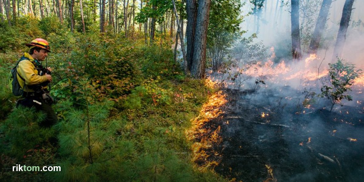
Western wildfire guidance emphasizes ember showers and structure ignition from above — relevant in steep terrain with dense chaparral. South Georgia fires behave differently. They typically move fast and low through ground cover, driven by wind. The practical priorities for rural and suburban properties in this region are:
Zone 1 — Immediate surroundings (0–30 feet from structures):
- Keep grass mowed short, especially within 30 feet of any structure. Dry tall grass is your biggest risk.
- Remove pine straw accumulation against foundations, decks, and fences. It ignites easily and stays burning.
- Trim lower branches on pine trees up to at least 6–10 feet — this breaks the "ladder fuel" that carries ground fire up into the tree crowns.
- Move firewood piles, propane tanks, and stored fuel away from structures.
Zone 2 — Extended perimeter (30–100 feet):
- Thin dense vegetation, particularly young pines growing in thick stands.
- Maintain a mowed or disked firebreak along your property boundary if you're adjacent to undeveloped pine or field land.
Disked firebreaks — strips of bare soil plowed or disked around a property perimeter — are common and effective on rural properties in South Georgia. Many county residents maintain them annually as a standard practice. If you're on a larger rural parcel, this is worth doing every fall before fire season begins.
Staying Informed When a Fire Starts
One of the most frustrating things about wildfire in South Georgia is the information gap. A fire can start two counties over, send visible smoke drifting across Lowndes County, and the only way most people find out what's burning is to call 911 or wait for a news story that may never come.
There are a few ways to stay better informed:
- Fire Watcher — Our Fire Watcher app pulls NASA FIRMS satellite fire detections across South Georgia and North Florida, updated every hour. When a fire is large enough to register on VIIRS or MODIS thermal sensors, it appears on the map with location, detection time, and confidence level. It also displays active NWS red flag warnings and fire weather watches. It's the fastest way to see if there's active fire activity in your area before the smoke reaches you.
- Georgia Forestry Commission. The GFC tracks active fires statewide and their public-facing information can be useful, though it often lags behind real-time satellite detection.
- Burn Permit Checker. Before any planned outdoor burn, the Burn Permit Checker shows your county’s current fire danger rating and any active burn bans in one place — so you’re not relying on yesterday’s conditions.
- Lowndes County Emergency Management. Sign up for AlertLowndes — the county's official emergency notification system, powered by Smart911 (it replaced CodeRED in 2024) — through the Lowndes County website for official evacuation notices and emergency communications. County emergency management agencies also issue local guidance and burn ban declarations — many use opt-in text or call alert systems, so know how your county communicates.
- NOAA Weather Radio. A battery-powered or hand-crank NOAA Weather Radio broadcasts continuous NWS forecasts and warnings — including fire weather watches — and will sound an alarm for warnings in your area even when the power and cell networks are down. For rural South Georgia households, it remains the single most reliable warning source.
- Wireless Emergency Alerts. Modern cell phones receive Wireless Emergency Alerts (WEA) for imminent threats automatically — make sure they’re enabled in your phone’s settings.
If a Fire Is Approaching
Ground-level wildfires in South Georgia can move faster than people expect, especially in wiregrass and dry broomsedge with wind behind them. If you see fire moving toward your property:
- Call 911 immediately — do not assume someone else has already called.
- Do not wait for an official evacuation order if the fire is close and moving fast. Leave early.
- Close all windows and doors before you leave — this slows smoke and ember intrusion significantly.
- Move vehicles away from structures if time allows.
- Shut off propane at the tank.
The Bottom Line
South Georgia's fire risk is real and underappreciated. The combination of fire-adapted pine forests, spring drought, and wind means that conditions for fast-moving fires occur multiple times each year. Basic preparedness — mowed grass, cleared pine straw, a trimmed perimeter — makes a genuine difference in whether a fire that reaches your property becomes a disaster. And staying informed through tools like Fire Watcher means you know what's happening in your county before the smoke is visible from your driveway.